


 Art & Design
 Auto & Vehicles
 Beauty
 Business
 Education
 Entertainment
 Finance
 Food & Drink
 Health & Fitness
 House & Home
 Libraries & Demo
 Lifestyle
 Maps & Navigation
 Medical
 Music & Audio
 Parenting
 Personalization
 Photography
 Productivity
 Shopping
 Social
 Sports
 Tools
Tools Travel & Local
 Video Players
 Weather
 Family


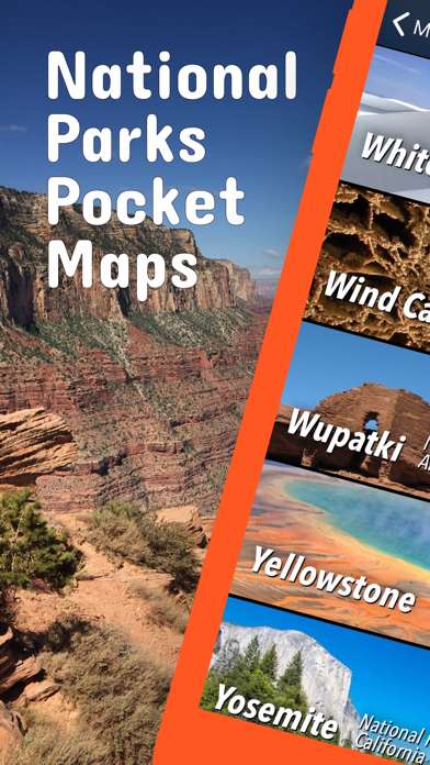
 National Parks Pocket Maps
OS :
Version :5.1
Size :328.35Mb
Updated :Sep 3,2022
Developer :Alex Gugel
 Ask AI
You can ask
the AI some questions about the app
Here are three topics that users may discuss about the National Parks Pocket Maps app, turned into limited-length questions:
1. What do you think about the accuracy of the park maps in this app?
2. Have you used any other national park guides or apps before downloading this one?
3. How easy was it for you to navigate the app's user interface and find the information you needed?
 Ask AI
Pros and Cons from users' feedback
Based on the users' reviews, here are three pros and three cons of the app:
**Pros:**
1. Provides accurate and detailed maps of national parks with updates.
2. Offers intuitive navigation and offline access for outdoor adventures.
3. Includes essential visitor information, such as park hours and trails.
**Cons:**
1. Some users report poor battery life and slow updates.
2. Limited search functionality for specific points of interest.
3. Prices can be high, especially for additional content and in-app purchases.
App
Downloads
<
>

App
Survey
-
Whether the app response speed affects the experience?
-
Whether the application ad recommendation affects the experience?
-
Do you think the payment of application features affects the experience?
-
How much traffic the app consumes Does it affect the experience?
Description
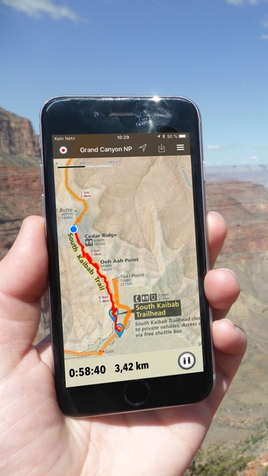
Be prepared! Plan your next trip to one of the great national parks. Download maps and guides before you venture into the Wi-Fi free wilderness.
Discover
- 500+ national parks, monuments, recreation areas, and all other National Park Service units
- 330+ neatly folded maps by the National Park Service
- 7,300+ campgrounds and campsites
- 11,400+ trails and trailheads
- 70,000+ points of interests
Plan
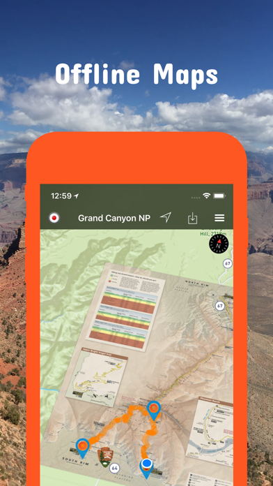
- Download maps, park brochures, and newspapers. These downloads are ready when you are offline and off the grid in the great outdoors.
- Download arbitrary map sections as offline packs.
- Photo galleries, panorama views.
- Share links to parks and maps with friends
Have fun
- GPS and GPX support: record your hikes, import GPX routes, tracks and waypoints for your hiking trails.
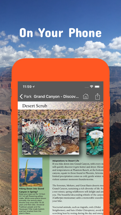
- Detailed national park information: alerts, news, visitor centers, campgrounds, driving directions, weather.
- Open your favorite maps app to get a route to the selected park.
- Current weather conditions, easy access to multi-day forecasts, sunrise and sunset times.
- Push notifications for park alerts, park news, weather warnings
So download maps and guides for:
Acadia
Arches
Badlands
Big Bend
Biscayne
Black Canyon of the Gunnison
Bryce Canyon
Canyonlands
Capitol Reef
Carlsbad Caverns
Channel Islands
Congaree,
Crater Lake
Death Valley
Denali
Dry Tortugas
Everglades
Gates of the Arctic
Glacier
Glacier Bay
Grand Canyon
Grand Teton
Great Basin
Great Smoky Mountains
Guadalupe Mountains
Hot Springs
Isle Royale
Joshua Tree
Katmai
Kenai Fjords
Kings Canyon
Lake Clark
Lassen Volcanic
Mammoth Cave
Mesa Verde
Mount Rainier
National Mall and Memorial Parks
North Cascades
Olympic
Petrified Forest
Pinnacles
Redwood
Rocky Mountain
Saguaro
Sequoia
Shenandoah
Theodore Roosevelt
Virgin Islands
Wind Cave
Yellowstone
Yosemite
Zion
There are lots of maps and brochures for national monuments, national preserves, national recreation areas, ..., like
Alagnak, Aniakchat, Antietam, Assateague Island, Aztec Ruins, Bandelier, Bering Land Bridge, Biscayne, Blue Ridge, Cabrillo, Canyon de Chelly, Cape Krusenstern, Capulin Volcano, Cedar Breaks, Chaco Culture, Chiricahua, Coronado, Curecanti, César E. Chávez, Devils Postpile, Dinosaur, El Malpais, El Morro, Florissant Fossil Beds, Fort Bowie, Fort Point, Gila Cliff Dwellings, Glen Canyon, Golden Gate, Golden Spike, Great Sand Dunes, Indiana Dunes, Lake Mead, Lava Beds, Mammoth Cave, Manzanar, Mojave, Montezuma Castle, Muir Woods, Natural Bridges, Navajo, Organ Pipe Cactus, Parashant, Pecos, Petroglyph, Point Reyes, Rainbow Bridge, Rosie the Riveter WWII Home Front, Salinas Pueblo Missions, San Antonio Missions, San Francisco Maritime, Santa Monica Mountains, Shenandoah, Sitka, Sunset Crater Volcano, Tuzigoot, Valles Caldera, Walnut Canyon, Whiskeytown, White Sands, Wupatki
and many more!
- FULL ACCESS is available for a for $3.49/three month (after a free 3-days trial period) or $2.49/two months or $7.49/year. You can subscribe and pay through your iTunes account. The account will be charged for renewal within 24-hours prior to the end of the current period, and identify the cost of the renewal. Your subscription will automatically renew unless canceled at least 24 hours before the end of the current period. Auto-renew can be turned off anytime by going to your Account Settings in iTunes after purchase.
- Continued use of GPS running in the background can dramatically decrease battery life.
LEGAL
Terms of Use: https://www.icoat.de/pocketmaps/terms
Privacy Policy: https://www.icoat.de/pocketmaps/privacy
{{descriptionMoreText}}
Comments (2)
{{commentText.length}}/{{maxCommentText}}
{{commentError}}{{commentUserError}}
-
{{comment.commentUser.substring(0, 1)}}By {{comment.commentUser}}{{comment.commentDateString}}
-
KBy KitCatElevenJul 27,2021
-
LBy Lambo2253May 19,2019
Developer apps


Category Top
apps
- Google Play
- App Store


More Apps


