


 Art & Design
 Auto & Vehicles
 Beauty
 Business
 Education
 Entertainment
 Finance
 Food & Drink
 Health & Fitness
 House & Home
 Libraries & Demo
 Lifestyle
 Maps & Navigation
 Medical
 Music & Audio
 Parenting
 Personalization
 Photography
 Productivity
 Shopping
 Social
 Sports
 Tools
Tools Travel & Local
 Video Players
 Weather
 Family


 Wildfire & Earthquake Tracker
OS :
Version :2.4
Size :43.76Mb
Updated :Oct 16,2020
Developer :corey hoggard
 Ask AI
You can ask
the AI some questions about the app
Here are three topics that users may discuss about the Wildfire Earthquake Tracker app:
1. What makes Wildfire Earthquake Tracker more informative than other earthquake tracking apps?
2. How accurate is the app's wildfire tracking feature in terms of locations and spread?
3. Does the app's emergency alert system help users take timely actions during natural disasters?
 Ask AI
App
Downloads
<
>
App
Survey
-
Does the update frequency of the application affect the experience?
-
Whether the app response speed affects the experience?
-
Application interactivity Does it affect the experience?
-
What is your Mobile System?
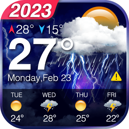
Description
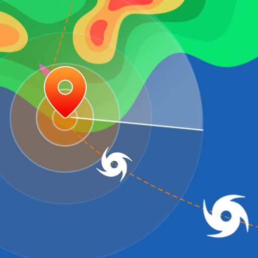
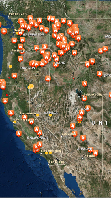
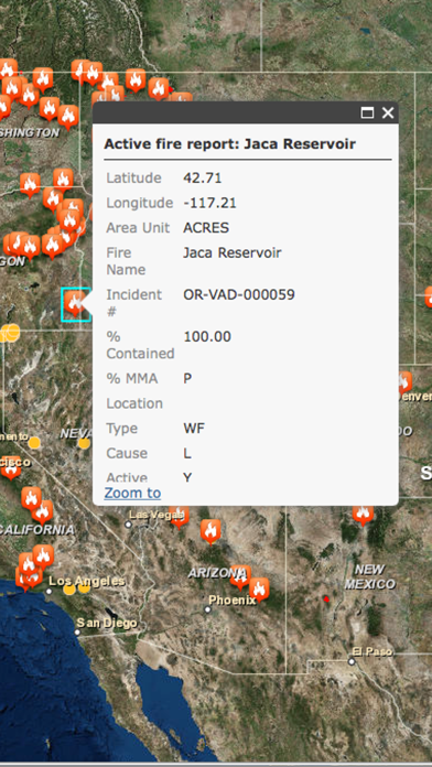
The Wildfire and Earthquake Tracker is an interactive mapping application that tracks US wildfires and Global earthquakes. The data feed comes from the USGS and and US Forestry Service. This map provides you with up to the minute data and access to global wildfire's as well as reported earthquakes.
-Wildfire Information and Location
-Earthquake Information and Location
-GPS integration
-Interactive Map
-Map Tables with data analysis
{{descriptionMoreText}}
Comments (0)
{{commentText.length}}/{{maxCommentText}}
{{commentError}}{{commentUserError}}
-
{{comment.commentUser.substring(0, 1)}}By {{comment.commentUser}}{{comment.commentDateString}}
Developer apps
 Global Surface Winds
 Hotel Deals Now
 Virginia Beach Tourist Guide
 Philadelphia Tourist Guide
 North Carolina Tourist Guide
 Chicago Tourist Guide
 Chicago Weather Radar
 Tennessee Tourist Guide
 Learn Guitar Chords Plus
 Simply Weather Radar
 US Weather Tornado Reports
 Nashville TN Tourist Guide
 US Weather Storm Reports
 Global Lightning Strikes Map
 Pittsburgh Tourist Guide
 Weather Models
 Agriculture Farming Weather
 Maine Tourist Guide
 OBX Tourist Guide
 Aviation Weather Doppler Radar
 New Orleans Tourist Guide
 Yellowstone Tourist Guide
 Myrtle Beach Tourist Guide
 US Weather Hail Reports
 5K Training Plan
 Weather Velocities Pro
 Branson Tourist Guide
 Free Camper Parking
 Washington DC Tourist Guide
 Waterfowl Duck Calls
 Blue Ridge Parkway Guide
 Washington DC Metro Map
 Storm Tracker Weather Radar
 Pigeon Forge Gatlingburg Guide
 NOAA Weather Radio Plus
 Ocean Wave Height
 Pacific Typhoon Tracker
 Pacific Hurricane Tracker
 Surf Buddy Wave Height
 Ocean Water Temperatures
 Snowfall Forecast
 Florida Hurricane Tracker
 Atlantic Hurricane Tracker
 OBX Hurricane Tracker
 HD Weather Doppler Radar
 Gulf Hurricane Tracker
 Active Wildfire Tracker Map
 Tornado Tracker Weather Radar
 US Lightning Strikes Map
Category Top
apps
- Google Play
- App Store


More Apps


